HOUSEHOLDS
WHAT IS HOUSEHOLD DATA?
Household Data comprises:
- Two digit country code by ISO 3166
- Administrative Code/ Postal Code/ Micro-Code
- Name of administrative area/ Name of the most populous administrative area/ Name of the respective micro-area or the next higher level
- Population year average: total number
- Population year average: per mill of country
- Households: total number
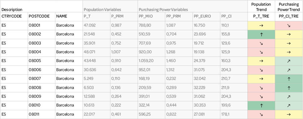
Sample of the Data Structure: Households on municipality level for the Czech Republic
| Admincode | Name | Population year average | Households year average |
|
| Municipality/Obce | number | per mill of country |
number | |
| 532100 | Blevice | 285 | 0,027 | 115 |
| 532169 | Buštěhrad | 2.791 | 0,265 | 1.220 |
| 532282 | Dřetovice | 500 | 0,048 | 209 |
| 532495 | Koleč | 623 | 0,059 | 265 |
| 532681 | Otvovice | 674 | 0,064 | 304 |
| 532827 | Slatina | 444 | 0,042 | 193 |
| 532851 | Stehelčeves | 723 | 0,069 | 324 |
| 532975 | Třebusice | 510 | 0,048 | 209 |
| 533092 | Zákolany | 541 | 0,051 | 249 |
| 534951 | Kralupy nad Vltavou | 17.726 | 1,685 | 8.057 |
| … | ||||
| Czech Republic | 10.518.570 | 1.000,000 | 4.567.667 | |
KEY DIFFERENTIATORS

Globally consistent and comparable data

Strict quality control

Individual consulting and support

Continuous updating

100 % GDPR compliant
COUNTRY AVAILABILITY
Europe | North America | South America | Asia | Oceania | Africa
DATA FORMATS
Tab delimited file (TXT) | KML | Access database (MDB) | Excel (xls) | Esri Shapefile (.shp) | Esri Geodatabase (.gdb) | MapInfo (.tab) | MapInfo MIF/MID | more on request
> LEARN MORE
TELL US WHERE YOU ARE HEADING.
WE WILL GLADLY ASSIST YOU IN SELECTING THE DATA NEEDED TO REACH YOUR GOAL.
Didn’t find what you are looking for or have another question? Please do not hesitate to contact us!
Our experts will be happy to advise you individually and without obligation on which data you can use to create added value for your company and realize savings.
Would you like to evaluate and visualize the data?


