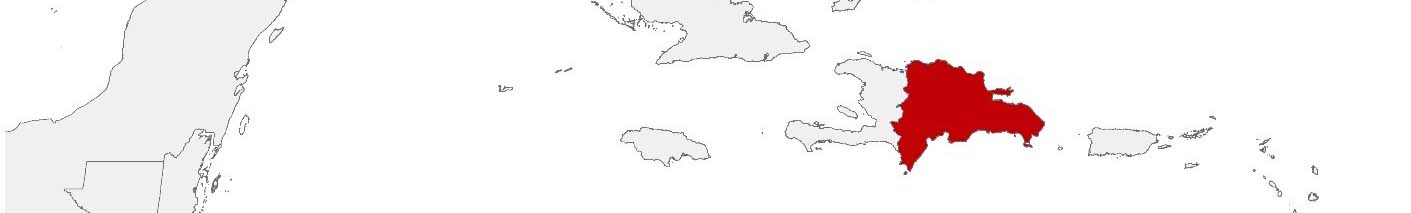
Dominican Republic Purchasing Power, Socio-demographics & Area Boundaries

Your trusted Source of Geodata for Dominican Republic for Postcode 5-digit, Municipios and Distritos Municipales
Discover a comprehensive suite of geodata for Dominican Republic from our extensive global data offering of sociodemographic and purchasing power data. Elevate your geomarketing, target group analyses, and location studies with our detailed insights. MBI provides accurate area boundaries (vector boundaries, polygons) with detailed, seamless coverage of the following areas: Postcode 5-digit, Municipios and Distritos Municipales. Our data’s global consistency and comparability enable you to draw comparisons between Dominican Republic and any other country worldwide. Additionally, political risk data allows you to develop targeted adaptation strategies to increase your location, logistics, and investment security.
Tailored for professionals in areas such as expansion planning, risk management, portfolio analysis, and statistical research, our data is accessible in all standard GIS formats and Excel. Licensed from MBI, this data ensures you have the robust information needed for strategic decision-making to drive your sales and business forward and maximize ROI.
Data that can currently be licensed from mbi for Dominican Republic
Each attribute or geographical level can be licensed individually.
| Geographic level | ||
|---|---|---|
| Area level | Administrative | Grid |
| Name | Municipios | 100 x 100 m |
| Number of areas | 158 | |
| Geometry | ||
| Polygons | ||
| Data / Variables | ||
| Population | ||
| Age bands | ||
| Sex / Gender | ||
| Households | ||
| Purchasing power | ||
| Marital status (country-specific) | ||
| Daytime Population | ||
| Socio Bundle Plus | ||
| Political Risk | ||
| Get a quote | Get a quote | |
| Additional Political Risk Data by Regions | ||||
|---|---|---|---|---|
| Regions | SUSAFE Basic | Calculated Trends | Conflict Insights | |
| Self-Explaining Political Risk Data | 32 | |||
| Get a quote | Get a quote | Get a quote | Get a quote | |
Geodata for the Dominican Republic: Enhancing Insights with Precise Localization
The Dominican Republic stands out in the Caribbean not only for its vibrant culture and stunning beaches but also for its dynamic economic landscape. In this context, precise geodata becomes an invaluable asset for businesses and organizations across various sectors. MBI’s geodata offerings for the Dominican Republic are tailored to harness the unique characteristics of the country, providing essential tools for geomarketing, GIS, expansion planning, spatial analysis, transportation planning, location intelligence analysis, and risk management.
Geographical Levels and Products
MBI’s geodata for the Dominican Republic is detailed for the administrative level of ‘Municipios’. The available products for this geographical level are designed to cater to a wide range of needs and applications, including:
- Population Data: Vital for understanding market size and demographics. Purchasing Power: Essential for identifying consumer spending capabilities.
- Purchasing Power: Essential for identifying consumer spending capabilities.
- Socio Demographics: Offers insights into population dynamics and key demographic indicators. Digital Boundaries: Crucial for accurate GIS mapping and spatial analysis.
- Digital Boundaries: Crucial for accurate GIS mapping and spatial analysis.
- Education Levels: Provides insights into the educational landscape of the population.
Use Case
Expansion Planning for Retail Chains: A leading retail chain might utilize MBI’s population and purchasing power geodata to identify underserved ‘Municipios’ with high market potential, leading to a strategic expansion that maximized revenue while optimizing distribution logistics.
Why Use Geodata from MBI for the Dominican Republic
MBI’s geodata for the Dominican Republic offers a foundation for a multitude of applications, from geomarketing and spatial analysis to risk management and urban planning. By providing detailed insights at the ‘Municipios’ level, MBI enables stakeholders across industries to make informed, data-driven decisions that leverage the unique opportunities and address the specific challenges of the Dominican Republic’s dynamic landscape.
Advantages of our administrative Boundaries
- Worldwide, seamless coverage of postal and administrative boundaries
- The layers are topographically correct and country borders fit seamlessly together without overlaps and gaps
- Data and areas can be easily combined in one layer thanks to a unique key, enabling cross-country analysis
- Constant updates guarantee a current data status
- The vintage compatibility between the MBI boundaries and the MBI Sociodemographic and Purchasing Power data is guaranteed
- Simple update by uniform layout of the layer names
- The higher-level area hierarchies are included with the boundary files
- Digital boundaries are in a vector format to allow visualization in any zoom levels
Smart Combination
The territorial vintages of the worldwide area boundaries are compatible with our globally consistent and comparable socio-economic data. We offer you a reliable basis for well-founded and data-based decisions. If desired, we can integrate the MBI data directly into our digital boundaries. So, you can load them directly into your system without any additional steps and use them immediately.
COUNTRY AVAILABILITY
Europe | North America | South America | Asia | Oceania | Africa
DATA FORMATS
Tab delimited file (TXT) | KML | Access database (MDB) | Excel (xls) | Esri Shapefile (.shp) | Esri Geodatabase (.gdb) | MapInfo (.tab, .tabx) | MapInfo MIF/MID | GeoJSON | GeoParquet (.parquet) | GeoPackage (.gpkg) | more on request
> LEARN MORE
TELL US WHERE YOU ARE HEADING.
WE WILL GLADLY ASSIST YOU IN SELECTING THE DATA NEEDED TO REACH YOUR GOAL.
Didn’t find what you are looking for or have another question? Please do not hesitate to contact us!
Our experts will be happy to advise you individually and without obligation on which data you can use to create added value for your company and realize savings.
Would you like to evaluate and visualize the data?