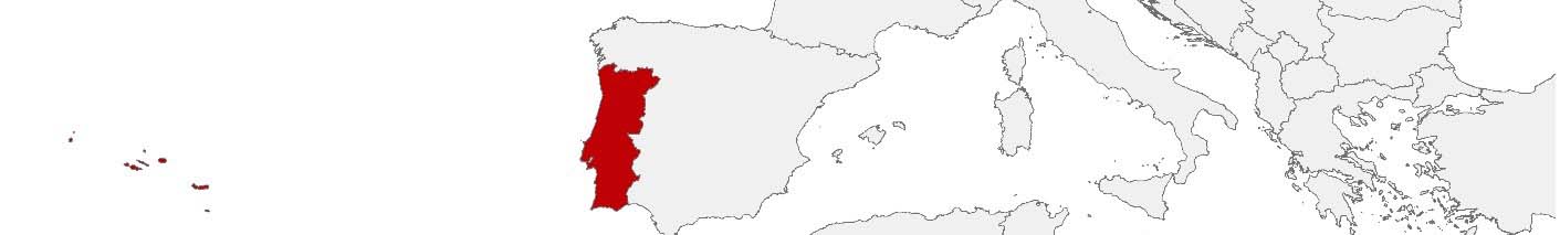
Portugal Purchasing Power, Socio-demographics & Area Boundaries

Your trusted Source of Geodata for Portugal for Postcode 4-digit, Postcode 7-digit, Freguesias, Census Subsections and 100 Meter Grid
Discover a comprehensive suite of geodata for Portugal from our extensive global data offering of sociodemographic and purchasing power data. Elevate your geomarketing, target group analyses, and location studies with our detailed insights. MBI provides accurate area boundaries (vector boundaries, polygons) with detailed, seamless coverage of the following areas: Postcode 4-digit, Postcode 7-digit, Freguesias, Census Subsections and 100 Meter Grid. Our data’s global consistency and comparability enable you to draw comparisons between Portugal and any other country worldwide. Additionally, political risk data allows you to develop targeted adaptation strategies to increase your location, logistics, and investment security.
Tailored for professionals in areas such as expansion planning, risk management, portfolio analysis, and statistical research, our data is accessible in all standard GIS formats and Excel. Licensed from MBI, this data ensures you have the robust information needed for strategic decision-making to drive your sales and business forward and maximize ROI.
Data that can currently be licensed from mbi for Portugal
Each attribute or geographical level can be licensed individually.
| Geographic level | |||||
|---|---|---|---|---|---|
| Area level | Post Code / ZIP Code | Post Code / ZIP Code | Administrative | Micro | Grid |
| Name | PC 4-digit | PC 7-digit | Freguesias | Subsecções Estatísticas | 100 x 100 m |
| Number of areas | 507 | 184440 | 3092 | 210170 | |
| Geometry | |||||
| Polygons | |||||
| Data / Variables | |||||
| Population | |||||
| Age bands | |||||
| Sex / Gender | |||||
| Households | |||||
| Unemployed | |||||
| Purchasing power | |||||
| Retail Spending | |||||
| Retail Turnover | |||||
| Retail Centrality | |||||
| Consumer Spending by Product Groups | |||||
| Households by Income Quintiles | |||||
| Education (country-specific) | |||||
| Marital status (country-specific) | |||||
| Consumer Styles | |||||
| Daytime Population | |||||
| Online-Shopping Affinity | |||||
| Socio Bundle Plus | |||||
| Political Risk | |||||
| Economic Risk | |||||
| Get a quote | Get a quote | Get a quote | Get a quote | Get a quote | |
| Additional Political Risk Data by Regions | ||||
|---|---|---|---|---|
| Regions | SUSAFE Basic | Calculated Trends | Conflict Insights | |
| Self-Explaining Political Risk Data | 31 | |||
| Get a quote | Get a quote | Get a quote | Get a quote | |
Geodata for Portugal: Fueling Business Growth with Comprehensive Data
Portugal is a dynamic country with rich maritime history, vibrant culture, and diverse landscapes. With a strong emphasis on innovation and competitiveness, Portugal offers numerous opportunities for businesses, both local and international. MBI’s comprehensive geodata provide essential insights that empower companies to make informed decisions, optimize operations, and tailor their strategies to meet market demands.
Geographical Levels and Products
MBI’s geodata for Portugal is structured across four significant levels, offering a comprehensive view suitable for various applications:
- Census-Subsections: This ultra-detailed level provides insights into the smallest administrative units in Portugal, covering data on Population, Daytime Population, Consumer Styles, Purchasing Power, Socio Demographics, and Digital Boundaries. It is pivotal for micro-level planning and development, facilitating precise strategies across urban and rural settings.
- Freguesias: Reflecting Portugal’s parishes, this level includes even more data products, such as Retail Turnover and Spending as well as Education, supporting comprehensive analysis and strategic planning. It’s invaluable for understanding local demographics, economic capabilities, and planning needs.
- Post Code 4-digit: Corresponding to Portugal’s postal code system, this level enables stakeholders to tailor strategies to regional characteristics and optimize service delivery.
- Grid: The 100 by 100 meter square grid is an alternative way of dividing Portugal that provides a granular overview of the population distribution.
Country-Specific Insights
Portugal offers a compelling market opportunity for a diverse range of companies, both European and non-European, seeking to expand their sales channels or access a skilled workforce at a competitive price point. Insights into census-subsection, parish (freguesia), and postal code-level demographics and economic trends support targeted business strategies, facilitating market entry, expansion, and customer segmentation. Additionally, digital boundary data is essential for planning and implementing projects that enhance connectivity, optimize retail locations, and streamline logistics operations, ensuring businesses can effectively reach and serve their target markets.
Use Case
A headphone manufacturer startup could use MBI’s geodata to decide about distribution channels in Portugal. By leveraging data on consumer spending by product groups, retail spending, and online shopping affinity, the company identifies the most promising distribution channels, for example through retail partnerships or e-commerce platforms, to effectively reach their target audience and maximize sales.
Why Use Geodata from MBI for Portugal
Investing in MBI’s geodata is a strategic advantage for businesses operating in Portugal. The detailed insights enable companies to enhance operational efficiency, optimize market strategies, and adapt to local conditions, ultimately driving growth and competitiveness in a rapidly evolving landscape.
Advantages of our administrative Boundaries
- Worldwide, seamless coverage of postal and administrative boundaries
- The layers are topographically correct and country borders fit seamlessly together without overlaps and gaps
- Data and areas can be easily combined in one layer thanks to a unique key, enabling cross-country analysis
- Constant updates guarantee a current data status
- The vintage compatibility between the MBI boundaries and the MBI Sociodemographic and Purchasing Power data is guaranteed
- Simple update by uniform layout of the layer names
- The higher-level area hierarchies are included with the boundary files
- Digital boundaries are in a vector format to allow visualization in any zoom levels
Smart Combination
The territorial vintages of the worldwide area boundaries are compatible with our globally consistent and comparable socio-economic data. We offer you a reliable basis for well-founded and data-based decisions. If desired, we can integrate the MBI data directly into our digital boundaries. So, you can load them directly into your system without any additional steps and use them immediately.
COUNTRY AVAILABILITY
Europe | North America | South America | Asia | Oceania | Africa
DATA FORMATS
Tab delimited file (TXT) | KML | Access database (MDB) | Excel (xls) | Esri Shapefile (.shp) | Esri Geodatabase (.gdb) | MapInfo (.tab, .tabx) | MapInfo MIF/MID | GeoJSON | GeoParquet (.parquet) | GeoPackage (.gpkg) | more on request
> LEARN MORE
TELL US WHERE YOU ARE HEADING.
WE WILL GLADLY ASSIST YOU IN SELECTING THE DATA NEEDED TO REACH YOUR GOAL.
Didn’t find what you are looking for or have another question? Please do not hesitate to contact us!
Our experts will be happy to advise you individually and without obligation on which data you can use to create added value for your company and realize savings.
Would you like to evaluate and visualize the data?