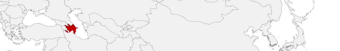
Azerbaijan Purchasing Power, Socio-demographics & Area Boundaries

Your trusted Source of Geodata for Azerbaijan for Postcode 2-digit and Rayonlar
Discover a comprehensive suite of geodata for Azerbaijan from our extensive global data offering of sociodemographic and purchasing power data. Elevate your geomarketing, target group analyses, and location studies with our detailed insights. MBI provides accurate area boundaries (vector boundaries, polygons) with detailed, seamless coverage of the following areas: Postcode 2-digit and Rayonlar. Our data’s global consistency and comparability enable you to draw comparisons between Azerbaijan and any other country worldwide. Additionally, political risk data allows you to develop targeted adaptation strategies to increase your location, logistics, and investment security.
Tailored for professionals in areas such as expansion planning, risk management, portfolio analysis, and statistical research, our data is accessible in all standard GIS formats and Excel. Licensed from MBI, this data ensures you have the robust information needed for strategic decision-making to drive your sales and business forward and maximize ROI.
Data that can currently be licensed from mbi for Azerbaijan
Each attribute or geographical level can be licensed individually.
| Geographic level | ||
|---|---|---|
| Area level | Administrative | Grid |
| Name | Rayonlar | 100 x 100 m |
| Number of areas | 74 | |
| Geometry | ||
| Polygons | ||
| Data / Variables | ||
| Population | ||
| Age bands | ||
| Sex / Gender | ||
| Purchasing power | ||
| Socio Bundle Plus | ||
| Political Risk | ||
| Get a quote | Get a quote | |
| Additional Political Risk Data by Regions | ||||
|---|---|---|---|---|
| Regions | SUSAFE Basic | Calculated Trends | Conflict Insights | |
| Self-Explaining Political Risk Data | 81 | |||
| Get a quote | Get a quote | Get a quote | Get a quote | |
Azerbaijan’s Geodata Insights: Enhancing Regional Development and Planning
Azerbaijan, a nation known for its rich cultural heritage and strategic Eurasian location, offers vast opportunities for development and growth. The country’s varied landscapes, from the Caspian Sea coastline to mountainous regions, underscore the necessity for precise geodata in planning and decision-making. MBI’s offerings, encapsulating all districts or Rayonlar, equip professionals in geomarketing, GIS, expansion planning, spatial analysis, transportation planning, location intelligence analysis, and risk management with essential insights.
Geographical Levels and Products
In Azerbaijan, MBI’s geodata covers:
- Population Data: Critical for demographic studies, infrastructure development, and public service planning.
- Purchasing Power: Offers insights into regional economic strength, supporting market analysis and investment strategies.
- Digital Boundaries: Enables accurate mapping and spatial analysis, crucial for environmental management, urban planning, and emergency response.
Country-Specific Insights
Azerbaijan’s economy, with its significant oil and gas sector, emerging tourism, and agriculture, benefits from the insights provided by detailed geodata. Understanding the distribution of population and purchasing power across districts assists in optimizing resource allocation, enhancing economic diversification efforts, and tailoring development projects to regional needs.
Use Case
One potential application is in the construction industry. By monitoring population and purchasing power trends, construction companies and local governments can ascertain the number of apartments in demand in each price segment for each district. Local governments can assess where additional social housing is needed to support economically weaker regions.
Why Use Geodata from MBI for Azerbaijan
MBI’s geodata offerings for Azerbaijan are invaluable tools for stakeholders looking to navigate the complexities of regional development and economic planning. By providing a comprehensive view of demographic, economic, and spatial dynamics, these insights enable informed decision-making, contributing to the sustainable growth and development of Azerbaijan’s diverse regions.
Advantages of our administrative Boundaries
- Worldwide, seamless coverage of postal and administrative boundaries
- The layers are topographically correct and country borders fit seamlessly together without overlaps and gaps
- Data and areas can be easily combined in one layer thanks to a unique key, enabling cross-country analysis
- Constant updates guarantee a current data status
- The vintage compatibility between the MBI boundaries and the MBI Sociodemographic and Purchasing Power data is guaranteed
- Simple update by uniform layout of the layer names
- The higher-level area hierarchies are included with the boundary files
- Digital boundaries are in a vector format to allow visualization in any zoom levels
Smart Combination
The territorial vintages of the worldwide area boundaries are compatible with our globally consistent and comparable socio-economic data. We offer you a reliable basis for well-founded and data-based decisions. If desired, we can integrate the MBI data directly into our digital boundaries. So, you can load them directly into your system without any additional steps and use them immediately.
COUNTRY AVAILABILITY
Europe | North America | South America | Asia | Oceania | Africa
DATA FORMATS
Tab delimited file (TXT) | KML | Access database (MDB) | Excel (xls) | Esri Shapefile (.shp) | Esri Geodatabase (.gdb) | MapInfo (.tab, .tabx) | MapInfo MIF/MID | GeoJSON | GeoParquet (.parquet) | GeoPackage (.gpkg) | more on request
> LEARN MORE
TELL US WHERE YOU ARE HEADING.
WE WILL GLADLY ASSIST YOU IN SELECTING THE DATA NEEDED TO REACH YOUR GOAL.
Didn’t find what you are looking for or have another question? Please do not hesitate to contact us!
Our experts will be happy to advise you individually and without obligation on which data you can use to create added value for your company and realize savings.
Would you like to evaluate and visualize the data?