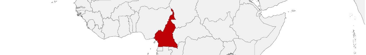
Cameroon Purchasing Power, Socio-demographics & Area Boundaries

Your trusted Source of Geodata for Cameroon for Arrondissements and Départements
Discover a comprehensive suite of geodata for Cameroon from our extensive global data offering of sociodemographic and purchasing power data. Elevate your geomarketing, target group analyses, and location studies with our detailed insights. MBI provides accurate area boundaries (vector boundaries, polygons) with detailed, seamless coverage of the following areas: Arrondissements and Départements. Our data’s global consistency and comparability enable you to draw comparisons between Cameroon and any other country worldwide. Additionally, political risk data allows you to develop targeted adaptation strategies to increase your location, logistics, and investment security.
Tailored for professionals in areas such as expansion planning, risk management, portfolio analysis, and statistical research, our data is accessible in all standard GIS formats and Excel. Licensed from MBI, this data ensures you have the robust information needed for strategic decision-making to drive your sales and business forward and maximize ROI.
Data that can currently be licensed from mbi for Cameroon
Each attribute or geographical level can be licensed individually.
| Geographic level | ||
|---|---|---|
| Area level | Administrative | Grid |
| Name | Départements | 100 x 100 m |
| Number of areas | 58 | |
| Geometry | ||
| Polygons | ||
| Data / Variables | ||
| Population | ||
| Political Risk | ||
| Get a quote | Get a quote | |
| Additional Political Risk Data by Regions | ||||
|---|---|---|---|---|
| Regions | SUSAFE Basic | Calculated Trends | Conflict Insights | |
| Self-Explaining Political Risk Data | 10 | |||
| Get a quote | Get a quote | Get a quote | Get a quote | |
Geodata Insights for Cameroon: Driving Development and Governance at the Departmental Level
Cameroon, often described as ‘Africa in miniature’ due to its geographical and cultural diversity, faces the challenge of harnessing this diversity for national development and social cohesion. The country’s vast landscapes range from coastal beaches to desert plains and dense rainforests, each with unique development and environmental management needs. MBI’s geodata for Cameroon’s Départements provides insightfull information for policymakers, development professionals, and local governments, enabling targeted planning, efficient resource allocation, and sustainable management practices.
Country-Specific Insights
Cameroon stands to gain considerably from the use of geodata in its development agenda, which places an emphasis on economic diversification, social inclusion and environmental sustainability. The identification of opportunities for growth, the resolution of disparities between regions and the prudent management of natural resources are all areas where geodata can play an important role. A data-driven approach facilitates the tailoring of interventions to the specific needs of each Département, enhancing their effectiveness and ensuring equitable development across the country.
Use Case
One potential use of MBI’s geodata in Cameroon is in the agricultural sector. Here, detailed data on population and land use within Départements can be mapped with the help of MBI Administrative Boundaries, informing initiatives to improve food security, support sustainable farming practices, and promote rural development.
Why Use Geodata from MBI for Cameroon
The geodata offerings for Cameroon are an excellent resource for navigating the complexities of national and regional development. By providing comprehensive insights into the demographic and spatial dynamics of its Départements, MBI’s geodata empowers stakeholders to make informed decisions, fostering sustainable development and enhancing the well-being of Cameroon’s diverse populations.
Advantages of our administrative Boundaries
- Worldwide, seamless coverage of postal and administrative boundaries
- The layers are topographically correct and country borders fit seamlessly together without overlaps and gaps
- Data and areas can be easily combined in one layer thanks to a unique key, enabling cross-country analysis
- Constant updates guarantee a current data status
- The vintage compatibility between the MBI boundaries and the MBI Sociodemographic and Purchasing Power data is guaranteed
- Simple update by uniform layout of the layer names
- The higher-level area hierarchies are included with the boundary files
- Digital boundaries are in a vector format to allow visualization in any zoom levels
Smart Combination
The territorial vintages of the worldwide area boundaries are compatible with our globally consistent and comparable socio-economic data. We offer you a reliable basis for well-founded and data-based decisions. If desired, we can integrate the MBI data directly into our digital boundaries. So, you can load them directly into your system without any additional steps and use them immediately.
COUNTRY AVAILABILITY
Europe | North America | South America | Asia | Oceania | Africa
DATA FORMATS
Tab delimited file (TXT) | KML | Access database (MDB) | Excel (xls) | Esri Shapefile (.shp) | Esri Geodatabase (.gdb) | MapInfo (.tab, .tabx) | MapInfo MIF/MID | GeoJSON | GeoParquet (.parquet) | GeoPackage (.gpkg) | more on request
> LEARN MORE
TELL US WHERE YOU ARE HEADING.
WE WILL GLADLY ASSIST YOU IN SELECTING THE DATA NEEDED TO REACH YOUR GOAL.
Didn’t find what you are looking for or have another question? Please do not hesitate to contact us!
Our experts will be happy to advise you individually and without obligation on which data you can use to create added value for your company and realize savings.
Would you like to evaluate and visualize the data?