Maldives Purchasing Power, Socio-demographics & Area Boundaries

Your trusted Source of Geodata for Maldives for Postcode 2-digit and Atolls
Discover a comprehensive suite of geodata for Maldives from our extensive global data offering of sociodemographic and purchasing power data. Elevate your geomarketing, target group analyses, and location studies with our detailed insights. MBI provides accurate area boundaries (vector boundaries, polygons) with detailed, seamless coverage of the following areas: Postcode 2-digit and Atolls. Our data’s global consistency and comparability enable you to draw comparisons between Maldives and any other country worldwide. Additionally, political risk data allows you to develop targeted adaptation strategies to increase your location, logistics, and investment security.
Tailored for professionals in areas such as expansion planning, risk management, portfolio analysis, and statistical research, our data is accessible in all standard GIS formats and Excel. Licensed from MBI, this data ensures you have the robust information needed for strategic decision-making to drive your sales and business forward and maximize ROI.
Data that can currently be licensed from mbi for Maldives
Each attribute or geographical level can be licensed individually.
| Geographic level | ||
|---|---|---|
| Area level | Administrative | Grid |
| Name | Atolls | 100 x 100 m |
| Number of areas | 21 | |
| Geometry | ||
| Polygons | ||
| Data / Variables | ||
| Population | ||
| Age bands | ||
| Sex / Gender | ||
| Households | ||
| Unemployed | ||
| Purchasing power | ||
| Socio Bundle Plus | ||
| Political Risk | ||
| Get a quote | Get a quote | |
| Additional Political Risk Data by Regions | ||||
|---|---|---|---|---|
| Regions | SUSAFE Basic | Calculated Trends | Conflict Insights | |
| Self-Explaining Political Risk Data | 29 | |||
| Get a quote | Get a quote | Get a quote | Get a quote | |
Geodata for the Maldives: Sustaining Paradise with Data-Driven Strategies
The Maldives, renowned for its idyllic islands, turquoise waters, and vibrant coral reefs, is a prime example of how geospatial data can underpin sustainable development in environmentally sensitive areas. As this archipelagic state faces challenges from climate change, tourism management, and economic diversification, leveraging precise geodata becomes critical for informed decision-making and policy formulation. MBI’s offerings for the Maldives are specifically designed to address these needs, providing essential insights for geomarketing, GIS, expansion planning, spatial analysis, transportation planning, location intelligence analysis, and risk management.
Geographical Levels and Products
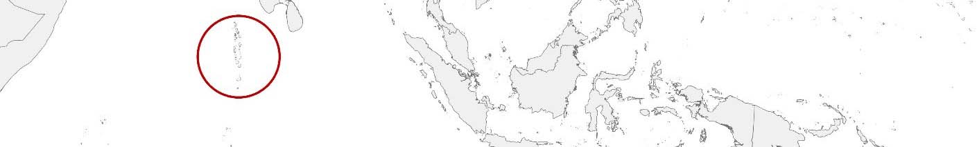
MBI’s geodata for the Maldives is available at the “Atolls” level. This level of detail is pivotal for understanding the distinct characteristics and needs of each atoll, facilitating targeted and effective development strategies. Available products include:
- Purchasing Power and Socio Demographics: Offers insights into economic capabilities and consumer spending potential, alongside detailed views of demographic characteristics, aiding market analysis, retail planning, and targeted development initiatives.
- Digital Boundaries: Essential for precise mapping and spatial analysis, this product supports environmental management, sustainable tourism planning, and strategic infrastructure development, ensuring projects align with the needs of local communities and conservation efforts.
Country-Specific Insights
In the Maldives, where the balance between tourism-driven economic growth and environmental sustainability is paramount, detailed geodata informs strategies across multiple sectors. Insights into atoll-level demographics and economic trends support initiatives in sustainable tourism, healthcare, education, and infrastructure development, aiming to enhance the quality of life for residents and improve resilience to environmental changes. Additionally, digital boundary data underpins the planning and execution of projects that protect natural resources and foster sustainable development across the islands.
Use Case
Climate Change Adaptation and Resilience Building: Utilizing digital boundaries, demographic insights and their own data, government agencies and international partners can implement projects to bolster climate resilience, focusing on coastal protection, water resource management, and disaster preparedness.
Why Use Geodata from MBI for Maldives
Stakeholders in the Maldives stand to benefit from choosing MBI’s geodata due to MBI’s commitment to providing highly accurate and detailed data tailored to the country’s unique economic and environmental landscape. MBI’s comprehensive data products offer critical insights into demographics, purchasing power, and consumer behavior, enabling businesses to make informed decisions, optimize market strategies, and drive sustainable growth. By leveraging MBI’s expertise in geodata, stakeholders can enhance their strategic planning, improve operational efficiency, and gain a competitive edge in various sectors, ensuring long-term success in the Maldives dynamic market.
Advantages of our administrative Boundaries
- Worldwide, seamless coverage of postal and administrative boundaries
- The layers are topographically correct and country borders fit seamlessly together without overlaps and gaps
- Data and areas can be easily combined in one layer thanks to a unique key, enabling cross-country analysis
- Constant updates guarantee a current data status
- The vintage compatibility between the MBI boundaries and the MBI Sociodemographic and Purchasing Power data is guaranteed
- Simple update by uniform layout of the layer names
- The higher-level area hierarchies are included with the boundary files
- Digital boundaries are in a vector format to allow visualization in any zoom levels
Smart Combination
The territorial vintages of the worldwide area boundaries are compatible with our globally consistent and comparable socio-economic data. We offer you a reliable basis for well-founded and data-based decisions. If desired, we can integrate the MBI data directly into our digital boundaries. So, you can load them directly into your system without any additional steps and use them immediately.
COUNTRY AVAILABILITY
Europe | North America | South America | Asia | Oceania | Africa
DATA FORMATS
Tab delimited file (TXT) | KML | Access database (MDB) | Excel (xls) | Esri Shapefile (.shp) | Esri Geodatabase (.gdb) | MapInfo (.tab, .tabx) | MapInfo MIF/MID | GeoJSON | GeoParquet (.parquet) | GeoPackage (.gpkg) | more on request
> LEARN MORE
TELL US WHERE YOU ARE HEADING.
WE WILL GLADLY ASSIST YOU IN SELECTING THE DATA NEEDED TO REACH YOUR GOAL.
Didn’t find what you are looking for or have another question? Please do not hesitate to contact us!
Our experts will be happy to advise you individually and without obligation on which data you can use to create added value for your company and realize savings.
Would you like to evaluate and visualize the data?