
Switzerland Purchasing Power, Socio-demographics & Area Boundaries
Your trusted Source of Geodata for Switzerland for Postcode 4-digit, Gemeinden, Postcode 6-digit and 100 Meter Grid
Discover a comprehensive suite of geodata for Switzerland from our extensive global data offering of sociodemographic and purchasing power data. Elevate your geomarketing, target group analyses, and location studies with our detailed insights. MBI provides accurate area boundaries (vector boundaries, polygons) with detailed, seamless coverage of the following areas: Postcode 4-digit, Gemeinden, Postcode 6-digit and 100 Meter Grid. Our data’s global consistency and comparability enable you to draw comparisons between Switzerland and any other country worldwide. Additionally, political risk data allows you to develop targeted adaptation strategies to increase your location, logistics, and investment security.
Tailored for professionals in areas such as expansion planning, risk management, portfolio analysis, and statistical research, our data is accessible in all standard GIS formats and Excel. Licensed from MBI, this data ensures you have the robust information needed for strategic decision-making to drive your sales and business forward and maximize ROI.
Data that can currently be licensed from mbi for Switzerland
Each attribute or geographical level can be licensed individually.
| Geographic level | ||||
|---|---|---|---|---|
| Area level | Post Code / ZIP Code | Administrative | Micro | Grid |
| Name | PC 4-digit | Gemeinden | PC 6-digit | 100 x 100 m |
| Number of areas | 3181 | 2118 | 4058 | |
| Geometry | ||||
| Polygons | ||||
| Data / Variables | ||||
| Population | ||||
| Age bands | ||||
| Sex / Gender | ||||
| Households | ||||
| Unemployed | ||||
| Purchasing power | ||||
| Retail Spending | ||||
| Retail Turnover | ||||
| Retail Centrality | ||||
| Consumer Spending by Product Groups | ||||
| Households by Income Quintiles | ||||
| Education (country-specific) | ||||
| Households by Type (country-specific) | ||||
| Marital status (country-specific) | ||||
| Consumer Styles | ||||
| Daytime Population | ||||
| Online-Shopping Affinity | ||||
| Socio Bundle Plus | ||||
| Political Risk | ||||
| Economic Risk | ||||
| Get a quote | Get a quote | Get a quote | Get a quote | |
| Additional Political Risk Data by Regions | ||||
|---|---|---|---|---|
| Regions | SUSAFE Basic | Calculated Trends | Conflict Insights | |
| Self-Explaining Political Risk Data | 26 | |||
| Get a quote | Get a quote | Get a quote | Get a quote | |
Geodata for Switzerland: Enhancing Precision in Development and Planning
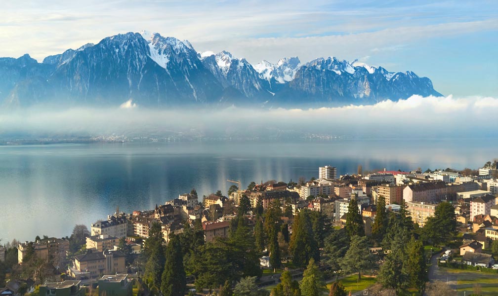
Switzerland, known for its precision, innovation, and high quality of life, is a hub of economic activity and technological advancement. Businesses operating within this unique geographical landscape, which includes vibrant cities, serene lakes, and the majestic Alps, benefit greatly from detailed geodata. MBI’s geodata offerings for Switzerland provide critical insights for geomarketing, GIS, expansion planning, spatial analysis, transportation planning, location intelligence analysis, and risk management, empowering national and international companies with the data needed for informed decision-making.
Geographical Levels and Products
MBI’s geodata for Switzerland is meticulously organized across four levels:
- Gemeinden (Municipalities): This level offers data on Population, Daytime Population, Digital Boundaries, and Socio Economics like Age Bands, Online Shopping Affinity or Retail Spending.
- Post Code 4-digit and 6 -digit (Postal Codes): Reflecting Switzerland’s postal code system, these levels offer even more granular insights on similar data products.
- Grid: Granular way of mapping population trends and distribution.
Country-Specific Insights
Despite its modest size, Switzerland boasts one of the most competitive economies in the world. The Swiss economy is primarily service-oriented. This includes the numerous banks and insurance companies that make Switzerland one of the world’s leading financial centers. Additionally, the country boasts a robust, export-oriented industrial sector. The Swiss watch industry is renowned worldwide for producing high-quality timepieces. To maintain and expand its competitiveness, Switzerland is continuously working on digitalization and a more independent, renewable energy supply. In this vibrant economic and investment environment, geodata provides a significant competitive advantage, enabling informed decision-making across sectors. The standard of living and quality of life in Switzerland are high, making it an attractive market for national and international companies. To establish a presence in this market and meet customer expectations, a company must leverage geodata to inform product development, communication, pricing, and sales strategies.
Use Case: Financial Services
Banks and insurance companies can utilize MBI’s geodata to assess socio-economic profiles and purchasing power across various municipalities. This detailed analysis helps them make informed decisions on branch placements, tailor financial products to regional demographics, and conduct thorough risk assessments.
Advantages of our administrative Boundaries
- Worldwide, seamless coverage of postal and administrative boundaries
- The layers are topographically correct and country borders fit seamlessly together without overlaps and gaps
- Data and areas can be easily combined in one layer thanks to a unique key, enabling cross-country analysis
- Constant updates guarantee a current data status
- The vintage compatibility between the MBI boundaries and the MBI Sociodemographic and Purchasing Power data is guaranteed
- Simple update by uniform layout of the layer names
- The higher-level area hierarchies are included with the boundary files
- Digital boundaries are in a vector format to allow visualization in any zoom levels
Smart Combination
The territorial vintages of the worldwide area boundaries are compatible with our globally consistent and comparable socio-economic data. We offer you a reliable basis for well-founded and data-based decisions. If desired, we can integrate the MBI data directly into our digital boundaries. So, you can load them directly into your system without any additional steps and use them immediately.
COUNTRY AVAILABILITY
Europe | North America | South America | Asia | Oceania | Africa
DATA FORMATS
Tab delimited file (TXT) | KML | Access database (MDB) | Excel (xls) | Esri Shapefile (.shp) | Esri Geodatabase (.gdb) | MapInfo (.tab, .tabx) | MapInfo MIF/MID | GeoJSON | GeoParquet (.parquet) | GeoPackage (.gpkg) | more on request
> LEARN MORE
TELL US WHERE YOU ARE HEADING.
WE WILL GLADLY ASSIST YOU IN SELECTING THE DATA NEEDED TO REACH YOUR GOAL.
Didn’t find what you are looking for or have another question? Please do not hesitate to contact us!
Our experts will be happy to advise you individually and without obligation on which data you can use to create added value for your company and realize savings.
Would you like to evaluate and visualize the data?