Andorra Purchasing Power, Socio-demographics & Area Boundaries

Your trusted Source of Geodata for Andorra for Postcode 5-digit, Parròquies and 100 Meter Grid
Discover a comprehensive suite of geodata for Andorra from our extensive global data offering of sociodemographic and purchasing power data. Elevate your geomarketing, target group analyses, and location studies with our detailed insights. MBI provides accurate area boundaries (vector boundaries, polygons) with detailed, seamless coverage of the following areas: Postcode 5-digit, Parròquies and 100 Meter Grid. Our data’s global consistency and comparability enable you to draw comparisons between Andorra and any other country worldwide. Additionally, political risk data allows you to develop targeted adaptation strategies to increase your location, logistics, and investment security.
Tailored for professionals in areas such as expansion planning, risk management, portfolio analysis, and statistical research, our data is accessible in all standard GIS formats and Excel. Licensed from MBI, this data ensures you have the robust information needed for strategic decision-making to drive your sales and business forward and maximize ROI.
Data that can currently be licensed from mbi for Andorra
Each attribute or geographical level can be licensed individually.
| Geographic level | |||
|---|---|---|---|
| Area level | Post Code / ZIP Code | Administrative | Grid |
| Name | PC 5-digit | Parròquies | 100 x 100 m |
| Number of areas | 7 | 7 | |
| Geometry | |||
| Polygons | |||
| Data / Variables | |||
| Population | |||
| Age bands | |||
| Sex / Gender | |||
| Households | |||
| Purchasing power | |||
| Marital status (country-specific) | |||
| Daytime Population | |||
| Socio Bundle Plus | |||
| Political Risk | |||
| Economic Risk | |||
| Get a quote | Get a quote | Get a quote | |
| Additional Political Risk Data by Regions | ||||
|---|---|---|---|---|
| Regions | SUSAFE Basic | Calculated Trends | Conflict Insights | |
| Self-Explaining Political Risk Data | 7 | |||
| Get a quote | Get a quote | Get a quote | Get a quote | |
Andorra’s Geodata Perspectives: Unlocking Strategic Insights in the Heart of the Pyrenees
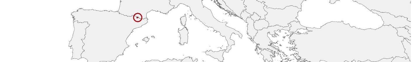
Andorra, a sovereign microstate nestled in the eastern Pyrenees mountains and bordered by France and Spain, offers a unique blend of stunning landscapes and a thriving economy based on tourism, retail, and banking. Despite its small size, Andorra’s diverse geographical and economic landscape presents unique opportunities for businesses and analysts. MBI’s geodata offerings for Andorra, encompassing detailed insights into its Parròquies (parishes) and postal codes, provide essential tools for professionals engaged in geomarketing, GIS, expansion planning, spatial analysis, transportation planning, location intelligence analysis, and risk management.
Geographical Levels and Products
In Andorra, MBI’s geodata is meticulously organized at two significant levels: Parròquies (parishes) and postal code area. This detailed geodata coverage offers a comprehensive suite of products designed to meet the nuanced needs of various applications:
For Parròquies and postal code areas, MBI’s offerings include:
- Population and Daytime Population Data: Crucial for understanding the demographic distribution and the dynamic movement of people, especially in a small country like Andorra, where tourism significantly influences population flow.
- Purchasing Power: Provides insights into the economic capabilities and consumer spending patterns within Andorra, invaluable for retail and service-oriented business strategies.
- Socio-Demographics: Delivers detailed insights into the population’s composition by age, income, employment, and other critical factors, facilitating targeted marketing and service provision.
- Digital Boundaries: Essential for precise spatial analysis and geographic mapping, supporting detailed GIS applications and location intelligence efforts.
Country-Specific Insights
Andorra’s economy, heavily influenced by its status as a tourist destination and its duty-free shopping, requires nuanced understanding for effective business and planning strategies. The detailed geodata MBI offers can significantly enhance decision-making processes, from optimizing retail locations to improve service delivery in sectors directly benefiting from tourism. Furthermore, Andorra’s unique status, with high purchasing power and specific consumer spending habits, allows for tailored marketing approaches and investment strategies, particularly in luxury goods and services.
Use Case
A practical application of MBI’s geodata in Andorra could be the strategic expansion of luxury retail chains. By analyzing purchasing power and socio-demographic data, the chains are able to identify key locations where their target demographic congregates, resulting in optimized store placements and inventory selections. Another example involves urban planning, where local authorities can utilize population movement and digital boundary data to enhance public transport routes and infrastructure, catering to both residents and the influx of tourists efficiently.
Why Use Geodata from MBI for Andorra
MBI’s geodata offerings for Andorra unlock a plethora of strategic insights, aiding professionals across various sectors to navigate the unique challenges and opportunities presented by this microstate. From geomarketing initiatives to sophisticated spatial analysis for urban planning, the depth and accuracy of the data provided are indispensable tools for achieving precision in decision-making and strategic planning. In the heart of the Pyrenees, Andorra’s economic and geographical landscapes offer a unique canvas, and with MBI’s geodata, professionals are well-equipped to paint their paths to success.
Advantages of our administrative Boundaries
- Worldwide, seamless coverage of postal and administrative boundaries
- The layers are topographically correct and country borders fit seamlessly together without overlaps and gaps
- Data and areas can be easily combined in one layer thanks to a unique key, enabling cross-country analysis
- Constant updates guarantee a current data status
- The vintage compatibility between the MBI boundaries and the MBI Sociodemographic and Purchasing Power data is guaranteed
- Simple update by uniform layout of the layer names
- The higher-level area hierarchies are included with the boundary files
- Digital boundaries are in a vector format to allow visualization in any zoom levels
Smart Combination
The territorial vintages of the worldwide area boundaries are compatible with our globally consistent and comparable socio-economic data. We offer you a reliable basis for well-founded and data-based decisions. If desired, we can integrate the MBI data directly into our digital boundaries. So, you can load them directly into your system without any additional steps and use them immediately.
COUNTRY AVAILABILITY
Europe | North America | South America | Asia | Oceania | Africa
DATA FORMATS
Tab delimited file (TXT) | KML | Access database (MDB) | Excel (xls) | Esri Shapefile (.shp) | Esri Geodatabase (.gdb) | MapInfo (.tab, .tabx) | MapInfo MIF/MID | GeoJSON | GeoParquet (.parquet) | GeoPackage (.gpkg) | more on request
> LEARN MORE
TELL US WHERE YOU ARE HEADING.
WE WILL GLADLY ASSIST YOU IN SELECTING THE DATA NEEDED TO REACH YOUR GOAL.
Didn’t find what you are looking for or have another question? Please do not hesitate to contact us!
Our experts will be happy to advise you individually and without obligation on which data you can use to create added value for your company and realize savings.
Would you like to evaluate and visualize the data?