Kazakhstan Purchasing Power, Socio-demographics & Area Boundaries

Your trusted Source of Geodata for Kazakhstan for Postcode 4-digit, Audandar and Oblystar
Discover a comprehensive suite of geodata for Kazakhstan from our extensive global data offering of sociodemographic and purchasing power data. Elevate your geomarketing, target group analyses, and location studies with our detailed insights. MBI provides accurate area boundaries (vector boundaries, polygons) with detailed, seamless coverage of the following areas: Postcode 4-digit, Audandar and Oblystar. Our data’s global consistency and comparability enable you to draw comparisons between Kazakhstan and any other country worldwide. Additionally, political risk data allows you to develop targeted adaptation strategies to increase your location, logistics, and investment security.
Tailored for professionals in areas such as expansion planning, risk management, portfolio analysis, and statistical research, our data is accessible in all standard GIS formats and Excel. Licensed from MBI, this data ensures you have the robust information needed for strategic decision-making to drive your sales and business forward and maximize ROI.
Data that can currently be licensed from mbi for Kazakhstan
Each attribute or geographical level can be licensed individually.
| Geographic level | |||
|---|---|---|---|
| Area level | Administrative | Administrative | Grid |
| Name | Audandar | Oblystar | 100 x 100 m |
| Number of areas | 221 | 20 | |
| Geometry | |||
| Polygons | |||
| Data / Variables | |||
| Population | |||
| Age bands | |||
| Sex / Gender | |||
| Households | |||
| Unemployed | |||
| Purchasing power | |||
| Marital status (country-specific) | |||
| Daytime Population | |||
| Socio Bundle Plus | |||
| Political Risk | |||
| Get a quote | Get a quote | Get a quote | |
| Political Risk Data | ||||
|---|---|---|---|---|
| Regions | SUSAFE Basic | Calculated Trends | Conflict Insights | |
| Self-Explaining Political Risk Data | 19 | |||
| Get a quote | Get a quote | Get a quote | Get a quote | |
Geodata for Kazakhstan: Empowering Businesses Across Steppes and Cities
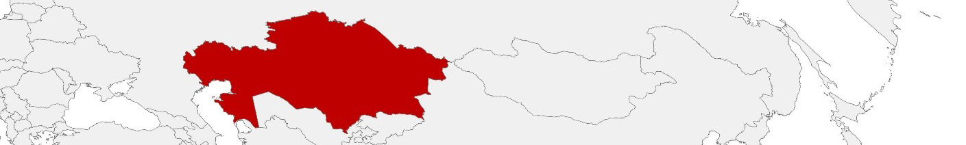
Kazakhstan, the largest landlocked country in the world, boasts a unique blend of vast steppes, modern cities, and significant natural resources. As a pivotal nation in Central Asia, it faces the dual challenge of managing its extensive rural areas while continuing to develop its urban centers. From urban development and infrastructure planning to market expansion and risk management, detailed and accurate geodata is essential. MBI’s offerings for Kazakhstan are designed to facilitate these initiatives, providing critical insights for geomarketing, GIS, expansion planning, spatial analysis, transportation planning, location intelligence analysis, and risk management.
Geographical Levels and Products
MBI’s geodata for Kazakhstan is detailed across two primary levels:
- Oblystar (Regions): This level covers the broad administrative divisions of Kazakhstan, offering a wide-angle view with products such as Population, Daytime Population, Purchasing Power, and Digital Boundaries. These data points are crucial for understanding regional demographics, economic capabilities, and planning needs.
- Audandar (Districts): Providing a more granular look at Kazakhstan’s districts, this level enables detailed analysis and targeted strategies with similar products. It’s invaluable for local planning and targeted marketing strategies.
Country-Specific Insights
In Kazakhstan, detailed geodata is crucial for businesses in sectors such as mining, agriculture, technology, and retail. Insights into regional and local socio-demographics and purchasing power inform strategic decisions and marketing efforts. Additionally, digital boundaries support infrastructure planning, aligning projects with Kazakhstan’s growth objectives.
Use Case
Marketing Campaign for Imported Products: A company importing mobile phones into Kazakhstan used MBI’s geodata to analyze daytime population, purchasing power and age bands in various regions. This enabled them to launch a targeted marketing campaign, selecting optimal locations for advertisements and promotional events to maximize reach and effectiveness.
Why Use Geodata from MBI for Kazakhstan
MBI’s geodata for Kazakhstan offers vital insights into the nation’s demographic, economic, and geographical landscape, enabling businesses to effectively address growth opportunities and operational challenges. By providing detailed information at the regional and district levels, MBI equips decision-makers with the tools necessary for informed strategic planning across various sectors.
Advantages of our administrative Boundaries
- Worldwide, seamless coverage of postal and administrative boundaries
- The layers are topographically correct and country borders fit seamlessly together without overlaps and gaps
- Data and areas can be easily combined in one layer thanks to a unique key, enabling cross-country analysis
- Constant updates guarantee a current data status
- The vintage compatibility between the MBI boundaries and the MBI Sociodemographic and Purchasing Power data is guaranteed
- Simple update by uniform layout of the layer names
- The higher-level area hierarchies are included with the boundary files
- Digital boundaries are in a vector format to allow visualization in any zoom levels
Smart Combination
The territorial vintages of the worldwide area boundaries are compatible with our globally consistent and comparable socio-economic data. We offer you a reliable basis for well-founded and data-based decisions. If desired, we can integrate the MBI data directly into our digital boundaries. So, you can load them directly into your system without any additional steps and use them immediately.
COUNTRY AVAILABILITY
Europe | North America | South America | Asia | Oceania | Africa
DATA FORMATS
Tab delimited file (TXT) | KML | Access database (MDB) | Excel (xls) | Esri Shapefile (.shp) | Esri Geodatabase (.gdb) | MapInfo (.tab, .tabx) | MapInfo MIF/MID | GeoJSON | GeoParquet (.parquet) | GeoPackage (.gpkg) | more on request
> LEARN MORE
TELL US WHERE YOU ARE HEADING.
WE WILL GLADLY ASSIST YOU IN SELECTING THE DATA NEEDED TO REACH YOUR GOAL.
Didn’t find what you are looking for or have another question? Please do not hesitate to contact us!
Our experts will be happy to advise you individually and without obligation on which data you can use to create added value for your company and realize savings.
Would you like to evaluate and visualize the data?