News
Boundary Maps for Europe
06/09/2009
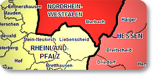
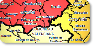
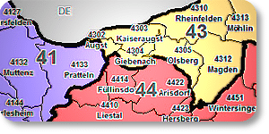
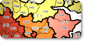
Now Available: Seamless Postcode and Administrative Boundaries of Europe
MB-International now offers a seamless boundary dataset for all of Europe, enabling cross border analysis. Valid area boundaries are needed to accurately analyse a store or business locations. They also provide a valuable input into targeted marketing campaigns and the visualization of their impacts. Without proper and correct area definition, whether this is Postcode or administative boundaries the key statistics that impact a business performance cannot be properly measured. For those using desktop GIS systems, the data sets are available as Vector ESRI Shape files or in MapInfo TAB files.