
Faroe Islands Purchasing Power, Socio-demographics & Area Boundaries
Your trusted Source of Geodata for Faroe Islands for Postcode 3-digit and Kommunur
Discover a comprehensive suite of geodata for Faroe Islands from our extensive global data offering of sociodemographic and purchasing power data. Elevate your geomarketing, target group analyses, and location studies with our detailed insights. MBI provides accurate area boundaries (vector boundaries, polygons) with detailed, seamless coverage of the following areas: Postcode 3-digit and Kommunur. Our data’s global consistency and comparability enable you to draw comparisons between Faroe Islands and any other country worldwide. Additionally, political risk data allows you to develop targeted adaptation strategies to increase your location, logistics, and investment security.
Tailored for professionals in areas such as expansion planning, risk management, portfolio analysis, and statistical research, our data is accessible in all standard GIS formats and Excel. Licensed from MBI, this data ensures you have the robust information needed for strategic decision-making to drive your sales and business forward and maximize ROI.
Data that can currently be licensed from mbi for Faroe Islands
Each attribute or geographical level can be licensed individually.
| Geographic level | |
|---|---|
| Area level | Administrative |
| Name | Kommunur |
| Number of areas | 29 |
| Geometry | |
| Polygons | |
| Data / Variables | |
| Population | |
| Age bands | |
| Sex / Gender | |
| Households | |
| Unemployed | |
| Daytime Population | |
| Socio Bundle Plus | |
| Political Risk | |
| Get a quote | |
| Additional Political Risk Data by Regions | ||||
|---|---|---|---|---|
| Regions | SUSAFE Basic | Calculated Trends | Conflict Insights | |
| Self-Explaining Political Risk Data | 6 | |||
| Get a quote | Get a quote | Get a quote | Get a quote | |
Geodata for the Faroe Islands: Navigating the North Atlantic with Precision
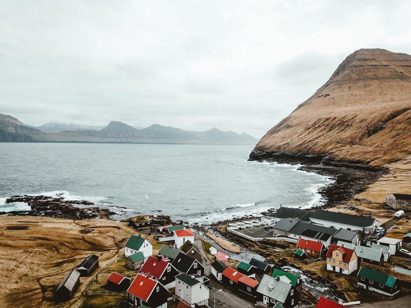
The Faroe Islands, an archipelago situated in the North Atlantic, are known for their rugged terrain, maritime culture, and self-sustaining communities. The unique geographical features of the islands, combined with their dynamic weather patterns, present distinct challenges for planning and development. MBI’s geodata offerings for the Faroe Islands are tailored to navigate these challenges, providing critical insights for geomarketing, GIS, expansion planning, spatial analysis, transportation planning, location intelligence analysis, and risk management.
Geographical Levels and Products
MBI’s geodata for the Faroe Islands is detailed at the “Kommunur” level. This allows for a deep understanding of the islands’ diverse communities and landscapes. The range of available products includes:
Digital Boundaries: Essential for accurate mapping and spatial analysis, facilitating infrastructure development and environmental management.
Population Data: Vital for demographic analysis and understanding community sizes and structures.
Daytime Population: Offers insights into population movement patterns, crucial for transportation and urban planning.
Socio Demographics: Provides a comprehensive view of the population’s characteristics, supporting targeted services and interventions.
Country-Specific Insights
Given the Faroe Islands’ emphasis on sustainable tourism, renewable energy, and fisheries, geodata plays a pivotal role in supporting these sectors. For instance, understanding the daytime population and socio-demographics is crucial for developing tourism services that cater to both local and international visitors. Similarly, digital boundaries and population data can aid in the planning and optimization of renewable energy projects, ensuring they harmonize with local communities and natural landscapes.
Advantages of our administrative Boundaries
- Worldwide, seamless coverage of postal and administrative boundaries
- The layers are topographically correct and country borders fit seamlessly together without overlaps and gaps
- Data and areas can be easily combined in one layer thanks to a unique key, enabling cross-country analysis
- Constant updates guarantee a current data status
- The vintage compatibility between the MBI boundaries and the MBI Sociodemographic and Purchasing Power data is guaranteed
- Simple update by uniform layout of the layer names
- The higher-level area hierarchies are included with the boundary files
- Digital boundaries are in a vector format to allow visualization in any zoom levels
Smart Combination
The territorial vintages of the worldwide area boundaries are compatible with our globally consistent and comparable socio-economic data. We offer you a reliable basis for well-founded and data-based decisions. If desired, we can integrate the MBI data directly into our digital boundaries. So, you can load them directly into your system without any additional steps and use them immediately.
COUNTRY AVAILABILITY
Europe | North America | South America | Asia | Oceania | Africa
DATA FORMATS
Tab delimited file (TXT) | KML | Access database (MDB) | Excel (xls) | Esri Shapefile (.shp) | Esri Geodatabase (.gdb) | MapInfo (.tab, .tabx) | MapInfo MIF/MID | GeoJSON | GeoParquet (.parquet) | GeoPackage (.gpkg) | more on request
> LEARN MORE
TELL US WHERE YOU ARE HEADING.
WE WILL GLADLY ASSIST YOU IN SELECTING THE DATA NEEDED TO REACH YOUR GOAL.
Didn’t find what you are looking for or have another question? Please do not hesitate to contact us!
Our experts will be happy to advise you individually and without obligation on which data you can use to create added value for your company and realize savings.
Would you like to evaluate and visualize the data?