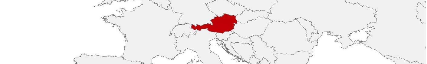
Austria Purchasing Power, Socio-demographics & Area Boundaries

Your trusted Source of Geodata for Austria for Postcode 4-digit, Gemeinden, Zählsprengel and 100 Meter Grid
Discover a comprehensive suite of geodata for Austria from our extensive global data offering of sociodemographic and purchasing power data. Elevate your geomarketing, target group analyses, and location studies with our detailed insights. MBI provides accurate area boundaries (vector boundaries, polygons) with detailed, seamless coverage of the following areas: Postcode 4-digit, Gemeinden, Zählsprengel and 100 Meter Grid. Our data’s global consistency and comparability enable you to draw comparisons between Austria and any other country worldwide. Additionally, political risk data allows you to develop targeted adaptation strategies to increase your location, logistics, and investment security.
Tailored for professionals in areas such as expansion planning, risk management, portfolio analysis, and statistical research, our data is accessible in all standard GIS formats and Excel. Licensed from MBI, this data ensures you have the robust information needed for strategic decision-making to drive your sales and business forward and maximize ROI.
Data that can currently be licensed from mbi for Austria
Each attribute or geographical level can be licensed individually.
| Geographic level | ||||
|---|---|---|---|---|
| Area level | Post Code / ZIP Code | Administrative | Micro | Grid |
| Name | PC 4-digit | Gemeinden | Zählsprengel | 100 x 100 m |
| Number of areas | 2234 | 2114 | 8842 | |
| Geometry | ||||
| Polygons | ||||
| Data / Variables | ||||
| Population | ||||
| Age bands | ||||
| Sex / Gender | ||||
| Households | ||||
| Unemployed | ||||
| Purchasing power | ||||
| Retail Spending | ||||
| Retail Turnover | ||||
| Retail Centrality | ||||
| Consumer Spending by Product Groups | ||||
| Households by Income Quintiles | ||||
| Education (country-specific) | ||||
| Households by Type (country-specific) | ||||
| Marital status (country-specific) | ||||
| Consumer Styles | ||||
| Daytime Population | ||||
| Online-Shopping Affinity | ||||
| Socio Bundle Plus | ||||
| Political Risk | ||||
| Economic Risk | ||||
| Get a quote | Get a quote | Get a quote | Get a quote | |
| Additional Political Risk Data by Regions | ||||
|---|---|---|---|---|
| Regions | SUSAFE Basic | Calculated Trends | Conflict Insights | |
| Self-Explaining Political Risk Data | 9 | |||
| Get a quote | Get a quote | Get a quote | Get a quote | |
Austria’s Geodata Insights: Enhancing Spatial Intelligence for Development
Austria, with its landscape shaped by the alps mountains, rich cultural heritage, and strong economy, stands as a prime example of how geodata can drive informed decision-making across various sectors. With a mix of urban sophistication and rural charm, Austria presents numerous opportunities for businesses seeking to leverage detailed geospatial data for effective planning and decision-making. MBI’s offerings, covering all municipalities (Gemeinden), Post Code 4-digit Areas, Micro Areas (Zählsprengel) and Grid (100×100 meter), provide critical insights for professionals in geomarketing, GIS, expansion planning, spatial analysis, transportation planning, location intelligence analysis, and risk management.
Geographical Levels and Available Products
MBI offers geodata for Austria across four geographical levels:
- Gemeinden (Municipalities): Gemeinden, or municipalities, form the basic administrative units in Austria. MBI’s products for Gemeinden include Retail Centrality and Retail Turnover, Consumer Styles, and Consumer Spending by Product Groups. These datasets are instrumental for businesses targeting local markets, enabling them to tailor their marketing strategies and product offerings to the specific preferences and behaviors of the residents.
- Zählsprengel (Census Tracts): The Zählsprengel level provides highly granular data, making it ideal for in-depth spatial analysis and detailed demographic studies. MBI’s offerings at this level include data on Nighttime and Daytime Population, Unemployed, and Purchasing Power, among others. These products support targeted marketing campaigns, detailed risk assessments, and comprehensive urban planning initiatives.
- Postal Code 4-digit (PC4): Postal codes offer a practical and widely used geographical layer for various applications, including direct mail marketing, logistics, and regional sales analysis. MBI’s datasets for PC4 regions encompass Households by Type, Education and Retail Centrality, facilitating efficient and effective marketing and operational strategies.
- Grid (100×100 meter): The 100 by 100 meter grid shows population distribution and trends in a very granular way.
Country-specific Insights
Austria’s stable economy, high standard of living, and diverse population create a complex geodata landscape. For instance, understanding consumer styles and purchasing power across Zählsprengel enables businesses to tailor their offerings and marketing strategies, enhancing customer engagement and market penetration.
Use Cases
A bank might utilize MBI’s Purchasing Power and Household Income Quintiles data to optimize its branch network and ATM placements. By analyzing income levels and spending patterns, the bank can identify underserved areas with high potential for new branches and ATMs, ensuring better customer access and improved service delivery.
Why Use Geodata from MBI for Austria
MBI provides highly detailed and accurate data across multiple geographical levels, ensuring reliable insights for various applications. From Nighttime Population and Consumer Styles to Purchasing Power and Digital Boundaries, MBI’s extensive product portfolio addresses diverse data needs. Tailored datasets for different geographical levels in Austria offer localized insights, crucial for effective decision-making and strategy formulation.
Advantages of our administrative Boundaries
- Worldwide, seamless coverage of postal and administrative boundaries
- The layers are topographically correct and country borders fit seamlessly together without overlaps and gaps
- Data and areas can be easily combined in one layer thanks to a unique key, enabling cross-country analysis
- Constant updates guarantee a current data status
- The vintage compatibility between the MBI boundaries and the MBI Sociodemographic and Purchasing Power data is guaranteed
- Simple update by uniform layout of the layer names
- The higher-level area hierarchies are included with the boundary files
- Digital boundaries are in a vector format to allow visualization in any zoom levels
Smart Combination
The territorial vintages of the worldwide area boundaries are compatible with our globally consistent and comparable socio-economic data. We offer you a reliable basis for well-founded and data-based decisions. If desired, we can integrate the MBI data directly into our digital boundaries. So, you can load them directly into your system without any additional steps and use them immediately.
COUNTRY AVAILABILITY
Europe | North America | South America | Asia | Oceania | Africa
DATA FORMATS
Tab delimited file (TXT) | KML | Access database (MDB) | Excel (xls) | Esri Shapefile (.shp) | Esri Geodatabase (.gdb) | MapInfo (.tab, .tabx) | MapInfo MIF/MID | GeoJSON | GeoParquet (.parquet) | GeoPackage (.gpkg) | more on request
> LEARN MORE
TELL US WHERE YOU ARE HEADING.
WE WILL GLADLY ASSIST YOU IN SELECTING THE DATA NEEDED TO REACH YOUR GOAL.
Didn’t find what you are looking for or have another question? Please do not hesitate to contact us!
Our experts will be happy to advise you individually and without obligation on which data you can use to create added value for your company and realize savings.
Would you like to evaluate and visualize the data?