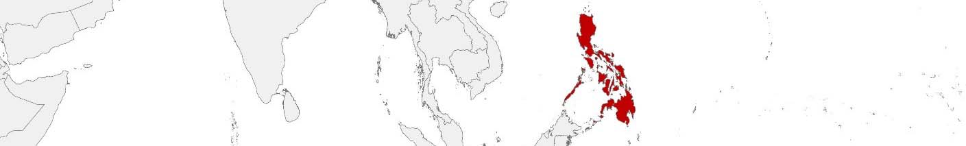
Philippines Purchasing Power, Socio-demographics & Area Boundaries

Your trusted Source of Geodata for Philippines for Postcode 4-digit, Municipalities and Cities and Barangays
Discover a comprehensive suite of geodata for Philippines from our extensive global data offering of sociodemographic and purchasing power data. Elevate your geomarketing, target group analyses, and location studies with our detailed insights. MBI provides accurate area boundaries (vector boundaries, polygons) with detailed, seamless coverage of the following areas: Postcode 4-digit, Municipalities and Cities and Barangays. Our data’s global consistency and comparability enable you to draw comparisons between Philippines and any other country worldwide. Additionally, political risk data allows you to develop targeted adaptation strategies to increase your location, logistics, and investment security.
Tailored for professionals in areas such as expansion planning, risk management, portfolio analysis, and statistical research, our data is accessible in all standard GIS formats and Excel. Licensed from MBI, this data ensures you have the robust information needed for strategic decision-making to drive your sales and business forward and maximize ROI.
Data that can currently be licensed from mbi for Philippines
Each attribute or geographical level can be licensed individually.
| Geographic level | |||
|---|---|---|---|
| Area level | Administrative | Micro | Grid |
| Name | Municipalities and Cities | Barangays | 100 x 100 m |
| Number of areas | 1641 | 42047 | |
| Geometry | |||
| Polygons | |||
| Data / Variables | |||
| Population | |||
| Age bands | |||
| Sex / Gender | |||
| Households | |||
| Purchasing power | |||
| Consumer Spending by Product Groups | |||
| Education (country-specific) | |||
| Marital status (country-specific) | |||
| Consumer Styles | |||
| Daytime Population | |||
| Online-Shopping Affinity | |||
| Socio Bundle Plus | |||
| Political Risk | |||
| Economic Risk | |||
| Get a quote | Get a quote | Get a quote | |
| Political Risk Data | ||||
|---|---|---|---|---|
| Regions | SUSAFE Basic | Calculated Trends | Conflict Insights | |
| Self-Explaining Political Risk Data | 20 | |||
| Get a quote | Get a quote | Get a quote | Get a quote | |
Geodata for the Philippines: Driving Economic Success Across the Archipelago
The Philippines, an archipelago of over 7,000 islands, is known for its diverse geography and rapidly growing economy. With a significant emphasis on industries such as retail, telecommunications, and tourism, understanding the geographic and demographic landscape is crucial for businesses operating in this dynamic market. MBI’s comprehensive geodata provides the insights needed for effective geomarketing, expansion planning, spatial analysis, and risk management.
Country-Specific Insights
The Philippines’ unique geographic distribution requires businesses to understand population density and economic activity on a granular level. For instance, Metro Manila, the capital region, is densely populated and economically vibrant, making it a focal point for retail and service industries. Conversely, rural areas and smaller islands may present different challenges and opportunities, such as varying purchasing power and different demographic profiles.
Use Case: Retail Expansion
A retail company planning to open new branches in the Philippines can use MBI’s nighttime and daytime population data to identify high-traffic areas within municipalities and cities. By analyzing purchasing power and Consumer Styles, the company can prioritize locations with the highest potential for sales.
Why Use Geodata from MBI for the Philippines
MBI’s geodata is indispensable for companies operating in the Philippines. By providing detailed insights into demographics, economic conditions, and population distribution, MBI enables businesses to make strategic decisions that enhance their competitiveness and operational efficiency. The granularity and accuracy of MBI’s data allow for tailored strategies that align closely with local market conditions. With accurate and comprehensive data, companies can better navigate the complexities of the Philippine market and capitalize on its growth opportunities, ensuring a competitive edge and sustainable growth.
Advantages of our administrative Boundaries
- Worldwide, seamless coverage of postal and administrative boundaries
- The layers are topographically correct and country borders fit seamlessly together without overlaps and gaps
- Data and areas can be easily combined in one layer thanks to a unique key, enabling cross-country analysis
- Constant updates guarantee a current data status
- The vintage compatibility between the MBI boundaries and the MBI Sociodemographic and Purchasing Power data is guaranteed
- Simple update by uniform layout of the layer names
- The higher-level area hierarchies are included with the boundary files
- Digital boundaries are in a vector format to allow visualization in any zoom levels
Smart Combination
The territorial vintages of the worldwide area boundaries are compatible with our globally consistent and comparable socio-economic data. We offer you a reliable basis for well-founded and data-based decisions. If desired, we can integrate the MBI data directly into our digital boundaries. So, you can load them directly into your system without any additional steps and use them immediately.
COUNTRY AVAILABILITY
Europe | North America | South America | Asia | Oceania | Africa
DATA FORMATS
Tab delimited file (TXT) | KML | Access database (MDB) | Excel (xls) | Esri Shapefile (.shp) | Esri Geodatabase (.gdb) | MapInfo (.tab, .tabx) | MapInfo MIF/MID | GeoJSON | GeoParquet (.parquet) | GeoPackage (.gpkg) | more on request
> LEARN MORE
TELL US WHERE YOU ARE HEADING.
WE WILL GLADLY ASSIST YOU IN SELECTING THE DATA NEEDED TO REACH YOUR GOAL.
Didn’t find what you are looking for or have another question? Please do not hesitate to contact us!
Our experts will be happy to advise you individually and without obligation on which data you can use to create added value for your company and realize savings.
Would you like to evaluate and visualize the data?