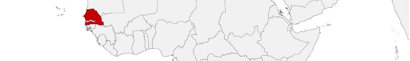
Senegal Purchasing Power, Socio-demographics & Area Boundaries

Your trusted Source of Geodata for Senegal for Postcode 5-digit, Départements and Régions
Discover a comprehensive suite of geodata for Senegal from our extensive global data offering of sociodemographic and purchasing power data. Elevate your geomarketing, target group analyses, and location studies with our detailed insights. MBI provides accurate area boundaries (vector boundaries, polygons) with detailed, seamless coverage of the following areas: Postcode 5-digit, Départements and Régions. Our data’s global consistency and comparability enable you to draw comparisons between Senegal and any other country worldwide. Additionally, political risk data allows you to develop targeted adaptation strategies to increase your location, logistics, and investment security.
Tailored for professionals in areas such as expansion planning, risk management, portfolio analysis, and statistical research, our data is accessible in all standard GIS formats and Excel. Licensed from MBI, this data ensures you have the robust information needed for strategic decision-making to drive your sales and business forward and maximize ROI.
Data that can currently be licensed from mbi for Senegal
Each attribute or geographical level can be licensed individually.
| Geographic level | |||
|---|---|---|---|
| Area level | Post Code / ZIP Code | Administrative | Administrative |
| Name | Postcode 5-digit | Départements | Régions |
| Number of areas | 161 | 46 | 14 |
| Geometry | |||
| Polygons | |||
| Data / Variables | |||
| Population | |||
| Age bands | |||
| Sex / Gender | |||
| Households | |||
| Purchasing power | |||
| Daytime Population | |||
| Get a quote | Get a quote | Get a quote | |
| Political Risk Data | ||||
|---|---|---|---|---|
| Regions | SUSAFE Basic | Calculated Trends | Conflict Insights | |
| Self-Explaining Political Risk Data | 14 | |||
| Get a quote | Get a quote | Get a quote | Get a quote | |
Geodata for Senegal: Catalyzing Development with Geospatial Intelligence
Senegal, a country celebrated for its democratic values, cultural richness, and economic potential, is actively pursuing economic growth and diversification, as well as improved infrastructure. Located at the westernmost point of Africa, Senegal offers numerous opportunities for businesses. The country boasts a wealth of natural resources, a thriving agricultural sector, numerous World Heritage Sites, several national parks, and a coastline with beaches that attract tourists from around the globe. The growing population has created a need to expand infrastructure, particularly in the capital city of Dakar. This could be met through cooperation with domestic and foreign companies. MBI’s geodata offerings for Senegal are tailored to meet these needs, providing critical insights for geomarketing, GIS, expansion planning, spatial analysis, transportation planning, location intelligence analysis, and risk management.
Geographical Levels and Products
MBI’s geodata for Senegal is available at the “Régions” level. The available products include:
- Population: Vital for demographic studies and planning, aiding in equitable resource distribution and targeted development initiatives across regions.
- Purchasing: Provides insights into economic capabilities, supporting market analysis, investment planning, and tailored development strategies.
- Digital Boundaries: Essential for accurate mapping and spatial analysis, supporting infrastructure development, ensuring projects are optimally located to serve the population and address specific regional needs effectively.
Use Case
A real estate company is exploring new construction sites in Senegal. By analyzing data on population, purchasing power, and digital boundaries, they identify prime locations for residential and commercial projects, ensuring optimal market reach and profitability.
Advantages of our administrative Boundaries
- Worldwide, seamless coverage of postal and administrative boundaries
- The layers are topographically correct and country borders fit seamlessly together without overlaps and gaps
- Data and areas can be easily combined in one layer thanks to a unique key, enabling cross-country analysis
- Constant updates guarantee a current data status
- The vintage compatibility between the MBI boundaries and the MBI Sociodemographic and Purchasing Power data is guaranteed
- Simple update by uniform layout of the layer names
- The higher-level area hierarchies are included with the boundary files
- Digital boundaries are in a vector format to allow visualization in any zoom levels
Smart Combination
The territorial vintages of the worldwide area boundaries are compatible with our globally consistent and comparable socio-economic data. We offer you a reliable basis for well-founded and data-based decisions. If desired, we can integrate the MBI data directly into our digital boundaries. So, you can load them directly into your system without any additional steps and use them immediately.
COUNTRY AVAILABILITY
Europe | North America | South America | Asia | Oceania | Africa
DATA FORMATS
Tab delimited file (TXT) | KML | Access database (MDB) | Excel (xls) | Esri Shapefile (.shp) | Esri Geodatabase (.gdb) | MapInfo (.tab, .tabx) | MapInfo MIF/MID | GeoJSON | GeoParquet (.parquet) | GeoPackage (.gpkg) | more on request
> LEARN MORE
TELL US WHERE YOU ARE HEADING.
WE WILL GLADLY ASSIST YOU IN SELECTING THE DATA NEEDED TO REACH YOUR GOAL.
Didn’t find what you are looking for or have another question? Please do not hesitate to contact us!
Our experts will be happy to advise you individually and without obligation on which data you can use to create added value for your company and realize savings.
Would you like to evaluate and visualize the data?