News
Thematic Maps
01/21/2010
Ever played with the idea of displaying postcode boundaries as an overlay in Google Earth?
I’m sure many of you have and are probably also aware of the many converters out there that can convert GIS boundary files to kml files.
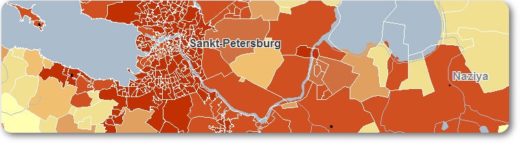
We have had a look into what the Google Earth application can and cannot do. One issue we found was that other than displaying the areas once converted into kml, one couldn’t do much with it. If the boundaries had values attached to them, they were only visible when clicking on the pushpins.
As we specialize in the collection of boundary maps and Socio and Economic data, we decided to see if we could find a way to display our data in Google Earth.
We are happy to announce that have found a way in which to display a thermatic map in Google Earth based on the values assigned to each polygon. This offers those not having a GIS software, an opportunity to visualize postcode or admin areas coloured according to the attributed data in a map. An added advantage is of course that the Google application offers the perfect backdrop map. As well as access to the Google content database, for those wanting to know where the competitors are located. There are limits and restriction to what it can do but it’s definably worth looking at. It’s no match to the GIS systems out there and we are not implying that it is but it’s an easy and very cost effective way to display a boundary map.
We can supply all our Boundary files in the kml format.
Please feel free to contact us should you need more information.