« All posts
« All press releases
Boundaries | News | Press
MBI Global Boundaries Release 2026 for Advanced Location Intelligence
04/08/2026
Karlsruhe, April 08th, 2026: Michael Bauer International GmbH (MBI) has announced the release 2026 of its Global Boundaries dataset, delivering a major upgrade in global geospatial data for location intelligence, GIS applications, and data-driven decision-making. With enhanced global coverage and increased granularity, the latest update empowers organizations to unlock deeper insights across markets, regions, and micro-locations worldwide.
A Comprehensive Global Dataset for GIS Workflows
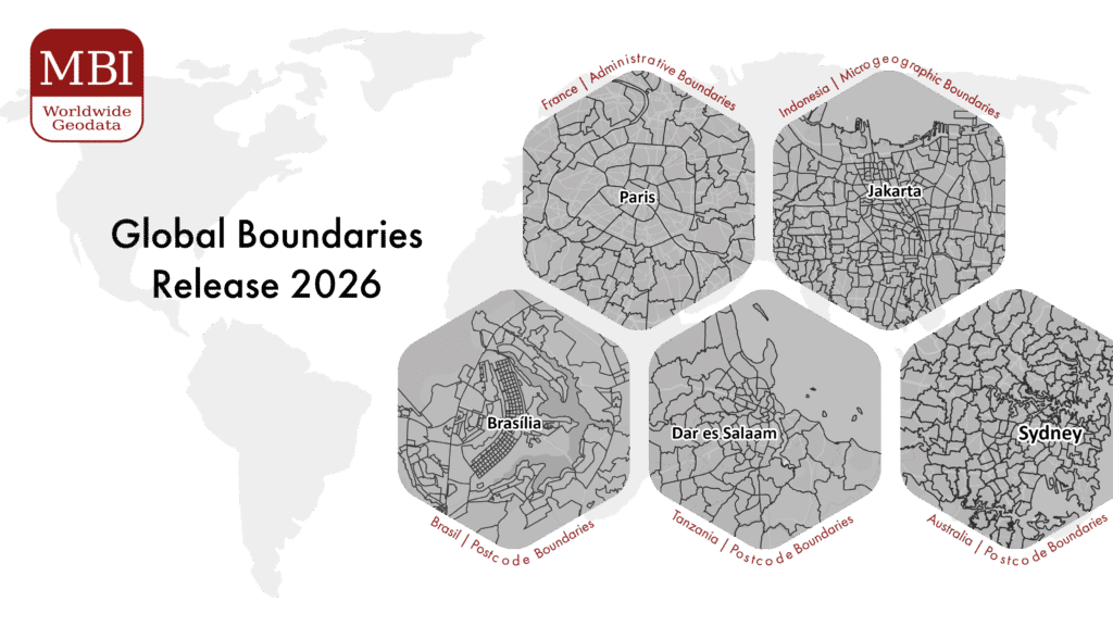
The Global Boundaries dataset covers 248 countries worldwide and includes a wide range of geographic layers, from administrative units to postcode boundaries and microgeographic structures. This breadth of coverage allows users to work across markets with a consistent data foundation, reducing the complexity often associated with international analysis.
A key strength of the dataset lies in its flexibility. It is available in multiple industry-standard formats such as ESRI Shapefile, GeoDatabase, GeoJSON, and GeoPackage, ensuring compatibility with virtually all GIS platforms and data environments. This makes it easy for organizations to integrate the data into existing workflows without the need for extensive preprocessing.
Enabling Better Decisions Through Spatial Analysis
At the core, Global Boundaries are designed to turn geographic data into actionable insight. By linking business data such as sales figures, customer locations, or operational metrics to precise geographic boundaries, organizations can visualize patterns that would otherwise remain hidden in spreadsheets.
This capability is particularly valuable in areas such as market analysis, site selection, and resource allocation. Instead of relying on broad regional averages, companies can drill down into highly specific geographic units, enabling more accurate targeting and more informed decision-making.
The result is not just better maps, but better strategies.
High Granularity Across Key Global Markets
One of the defining features of the 2026 release is its level of detail. MBI provides access to more than 2,000 geographic levels globally, allowing users to analyze data at a depth that matches their specific use case. Examples of available levels include:
Europe
| Country | Administrative Level | Postcode Level | Microgeographical Level |
| France | Communes (34 788) | 5-digit PC (6 051) | IRIS (48 573) |
| Italy | Comuni (7 896) | 5-digit PC (4 700) | Sezioni di Censimento (748 306) |
| Poland | Gminy i Miasta (3 229) | 5-digit PC (20 457) | Obwody Spisowe (192 598) |
| United Kingdom | Districts (361) | PC Units (1683 580) | Census Output Areas (23 9023) |
North America
| Country | Administrative Level | Postcode Level | Microgeographical Level |
| Canada | Census Subdivisions (5 028) | 6-digit PC (838 605) | Dissemination Blocks (498 548) |
| Mexico | Municipios (2 475) | 5-digit PC (32 013) | Áreas Geoestadísticas Básicas urbanas y Municipios (66 437) |
| Puerto Rico | Barrios (901) | 5-digit PC (132) | Grupos de Bloques Censales (2 513) |
| USA | County Subdivisions (35 390) | 5-digit PC (33 774) | Block Groups (239 233) |
Asia
| Country | Administrative Level | Postcode Level | Microgeographical Level |
| India | Sub-Districts (6 996) | 6-digit PC (19 373) | Wards and Sub-Districts (11 196) |
| Indonesia | Kabupaten dan Kota (514) | 5-digit PC (11 594) | Desa dan Kelurahan (83 779) |
| Japan | Shikuchōson (1 892) | 7-digit PC (115 354) | Shōchiiki (220 635) |
| Philippines | Municipalities (1 641) | 4-digit PC (1 896) | Barangays (42 028) |
Oceania
| Country | Administrative Level | Postcode Level | Microgeographical Level |
| Australia | Local Government Areas (546) | 4-digit PC (2 640) | Mesh Blocks (368 049) |
| New Zealand | Statistical Areas 2 (2 311) | 4-digit PC (1 082) | Meshblocks (56 789) |
South America
| Country | Administrative Level | Postcode Level | Microgeographical Level |
| Brazil | Municípios (5 571) | 5-digit PC (26 555) | Setores Censitários (468 091) |
| Colombia | Municipios (1 122) | 6-digit PC (3 681) | Secciones (76 563) |
| Ecuador | Parroquias (1 046) | 6-digit PC (1 225) | Sectores Censales (52 946) |
| Uruguay | Secciones Censales (235) | 5-digit PC (121) | Zonas Censales (78 033) |
Africa
| Country | Administrative Level | Postcode Level | Microgeographical Level |
| Nigeria | Local Government Areas (774) | 4-digit PC (339) | – |
| Morocco | Communes (1 687) | 5-digit PC (1 929) | – |
| Tanzania | Wilaya (195) | 5-digit PC (4 066) | Kata (4 344) |
| Tunisia | Al – ʿImādat (2 085) | 4-digit PC (944) | – |
This level of precision enables organizations to move beyond country-level or regional analysis and instead focus on the local dynamics that often drive real business outcomes.
Data Quality You Can Rely On
One of the major challenges in global datasets is inconsistency between countries and levels. MBI addresses this by applying a unified data process across all geographies, avoiding the fragmentation often seen in aggregated or third-party compiled datasets.
MBI Global Boundaries are built through a controlled production process that prioritizes accuracy, consistency, and long-term maintainability. Each dataset undergoes:
- Standardization across countries and levels
- Topology validation and gap-free coverage
- Attribute harmonization for cross-border comparability
- Continuous updates aligned with official statistical and administrative sources
A key advantage of MBI Global Boundaries is its 1:1 compatibility with MBI Global Market Data, enabling users to seamlessly combine geographic boundaries with detailed demographic and market data. This unique integration allows for immediate, analysis-ready workflows without the need for complex data matching or reconciliation.
This ensures that users are not just working with data, but with a reliable geographic framework that supports enterprise-grade decision-making.
A Foundational Layer for Location Intelligence
MBI Global Boundaries are not just a dataset, they act as a standardized geographic backbone for organizations operating across multiple markets. Whether in retail, logistics, telecommunications, or finance, location intelligence plays a critical role in understanding markets and optimizing operations. By ensuring consistency across countries and levels, MBI removes one of the biggest barriers in global analytics: incompatible geographic structures.
Retailers can use the data to refine store network planning, while logistics providers benefit from improved route optimization and delivery efficiency. In finance and insurance, geographic segmentation supports more accurate risk assessment and helps identify new growth opportunities. Detailed boundary data also plays an important role in healthcare and public sector planning, enabling better service distribution and infrastructure development.
“Most organisations underestimate how much poor geographic data limits their analysis. What we provide with Global Boundaries 2026 is a consistent, high-resolution geographic framework that removes that limitation and allows teams to work with confidence across markets” says Ray Roberts-York, Managing Director at MBI.
This versatility makes the dataset a valuable foundation for any organization working with spatial data. Organizations interested in leveraging the MBI Digital Boundaries dataset can request further information on available geographic levels, regional packages, and integration options from our Sales Team.