Geodata for EUROPE
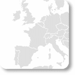
Here is an overview from our data offering for small-scale international market and geographic data of the European countries. We offer data on a variety of geographical levels, such as postcode boundaries (ZIP), administrative boundaries and micro area maps for your catchment area analysis and sales territory planning.
On the country overviews, you will find the available area boundaries and socio-economic data. Please select your country of interest.
- Albania
- Andorra
- Austria
- Belarus
- Belgium
- Bosnia and Herzegovina
- Bulgaria
- Croatia
- Cyprus
- Czech Republic
- Denmark
- Estonia
- Faroe Islands
- Finland
- France
- Germany
- Greece
- Hungary
- Iceland
- Ireland
- Italy
- Kosovo
- Latvia
- Liechtenstein
- Lithuania
- Luxembourg
- Malta
- Moldova
- Monaco
- Montenegro
- Netherlands
- North Macedonia
- Norway
- Poland
- Portugal
- Romania
- Russian Federation
- Serbia
- Slovakia
- Slovenia
- Spain
- Sweden
- Switzerland
- Turkey
- Ukraine
- United Kingdom
If desired, we can integrate the socio-economic data directly into our digital boundaries. So, you can load them directly into your system without any additional steps and use them immediately.
COUNTRY AVAILABILITY
Europe | North America | South America | Asia | Oceania | Africa
DATA FORMATS
Tab delimited file (TXT) | KML | Access database (MDB) | Excel (xls) | Esri Shapefile (.shp) | Esri Geodatabase (.gdb) | MapInfo (.tab) | MapInfo MIF/MID | more on request
DATALINK API
Easy access to a variety of MBI data
• Datalink Desktop
• Datalink Rest API